




| WEATHER STORY Milwaukee/Sullivan Weather Forecast Office |
|
|||
 |
|||
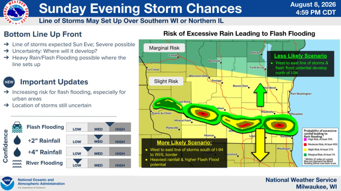
| Additional showers and thunderstorms are expected to develop from west to east across a portion of the area, but the exact location and strength of this activity will depend on the morning round. Wherever this round of storms develops, it has the potential to bring heavy rainfall and flash flooding along with pockets of severe weather. The best potential for this line will be south of I-94 toward the WI/IL border, but a northward shift cannot be completely ruled out. |
Select a Different Office Below
Data Courtesy of Milwaukee/Sullivan Weather Forecast Office